
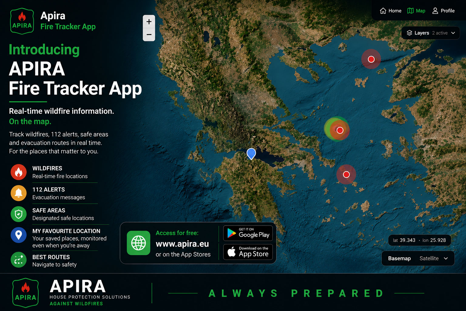
The APIRA Fire Tracker App is a specialized wildfire awareness tool developed by APIRA, a climate-tech company focused on holistic wildfire home protection solutions. The app helps property owners, families, and individuals stay safe and informed when wildfires break out nearby.
APIRA Fire Tracker App Key Features & How It Works
- Location Monitoring for What Matters: Unlike standard maps, the APIRA Fire Tracker allows you to track and save multiple custom locations, such as your permanent home, a holiday house, a workplace, or a family member’s property.
- Proximity Visualization: It maps active wildfire feeds instantly, giving you a clear visual breakdown of exactly how close a fire is to your saved properties or your current live mobile location
- Actionable Evacuation Guidance: When every minute matters, the app bridges the gap between tracking and action. It displays designated safe zones and gives practical route guidance to help you navigate away from danger.
- Completely Free: It is 100% free to use and requires no paid tiers to access critical fire tracking data.
Where to Access APIRA Fire Tracker App
- Web Version: You can use the browser-based platform instantly with no download required by visiting the APIRA Interactive Map Tool. Free to use. No download required.
- Mobile App: The dedicated mobile application is designed for quick, on-the-move tracking and is available for download on iOS and Android devices.
Staying Safe in Wildfire Season
Why the APIRA Fire Tracker App belongs on your Phone
When a wildfire breaks out nearby, minutes matter. Unfortunately, during a crisis, finding reliable information can feel impossible. Homeowners are often forced to scramble between local news, police scanner feeds, and chaotic social media updates just to figure out if they need to pack up and leave.
That is where APIRA comes in. Known primarily for their cutting-edge, waterless physical home protection barriers, the climate-tech company has released a digital solution to help families navigate fire season safely: the APIRA Fire Tracker App. This 100% free app replaces emergency-tracking guesswork with real-time, consolidated satellite data. Here is a closer look at what it does, who it’s for, and why it is a critical tool for your digital emergency kit.
Peace of Mind for Families
While the app is a lifesaver during an active evacuation, it is equally valuable for daily peace of mind and preparation:
- Protecting Long-Distance Family: If you have elderly parents living in a high-risk rural area, you can pin their address in your app. If a fire starts nearby, you will know immediately, so you can call them and coordinate help before local sirens even sound.
- Pre-Planning Evacuation Routes: Don’t wait for an emergency to familiarize yourself with your surroundings. Use the app to view your property’s location, nearby safe areas, and available route guidance.
- Safe Traveling and Camping: If you love hiking, camping, or road-tripping through forested regions, check the app before you set up camp to ensure you aren’t inadvertently heading into an active or high-risk fire boundary.
The Ultimate Wildfire “Go-Bag” Checklist
Pair your digital tools with physical readiness. If the APIRA app alerts you that a fire is approaching, ensure your Go-Bag is packed with these absolute essentials:
- Critical Documents: Pack passports, IDs, birth certificates, and insurance policies in a waterproof sleeve (or back them up on a secure USB drive).
- 3-Day Survival Supplies: At least 3 liters of water per person per day, non-perishable food, a manual can opener, and a first-aid kit.
- Tech & Power: Portable power banks and charging cables to keep your phone running so you can maintain access to the APIRA map and local alerts.
- Respiratory Protection: FFP2 or FFP3 masks (certified to EN 149 with a visible CE mark) to protect your lungs from heavy wildfire smoke and ash during evacuation. (For US Standards: N95 or P100 masks).
More Than Just a Map
The APIRA Fire Tracker isn’t just a static map showing where fires are burning. It is designed dynamically to bridge the gap between tracking a threat and taking decisive action.
- Multi-Location Monitoring: Instead of checking only your current GPS location, the app lets you save and monitor multiple specific addresses. You can pin your permanent residence, a holiday home, your workplace, or an elderly relative’s home.
- Proximity Visualization: The interface clearly maps active wildfire feeds alongside your saved properties, giving you an instant visual breakdown of exactly how close a reported wildfire activity is to the things you care about most.
- Actionable Evacuation Guidance: If a fire gets too close, the app maps out designated safe zones and provides clear route guidance to help you navigate away from danger zones safely.
Built on Trusted Data
When it comes to wildfire awareness, reliable information matters. The APIRA Fire Tracker brings together data and information from sources, including NASA’s FIRMS data, Copernicus, official 112 emergency alerts, and information provided by volunteer groups. This helps users access relevent and emergency information in one place.
A Holistic Approach to Fire Safety
The Fire Tracker App is just one piece of APIRA’s mission to shield communities from climate risks. While the app helps you monitor threats and flee safely, the company also specializes in advanced, passive physical barriers designed to protect structures from extreme radiant heat and embers without requiring water or electricity.
By combining digital awareness with physical home defense, property owners can finally take control of their wildfire readiness strategy.